The North Loop Trailhead is the gateway to several epic hikes in the Mt. Charleston Wilderness Area.
Notice: Mt. Charleston recently experienced substantial storm damage from Hurricane Hillary. Be sure to check for updated information about closures here.
In this guide:
- Trails that start at the North Loop Trailhead
- Getting to the Trailhead
- Parking Information
- Trail Amenities
- Trail Rules
Trails starting at the North Loop Trailhead
The North Loop Trailhead services several hiking trails in the area:
Additionally, there are junctions to Wildhorse Canyon and Trail Canyon.
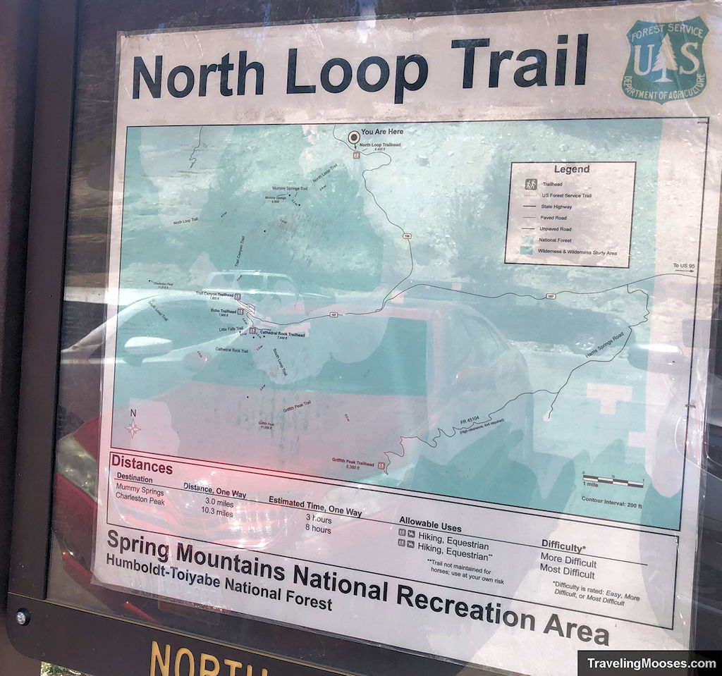
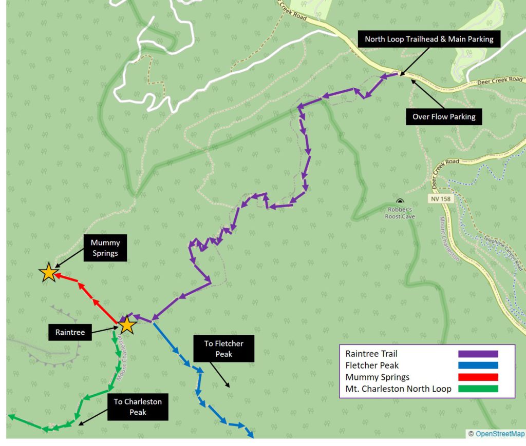
North Loop Trailhead Hiking Map
Mt. Charleston Peak via North Loop Trail
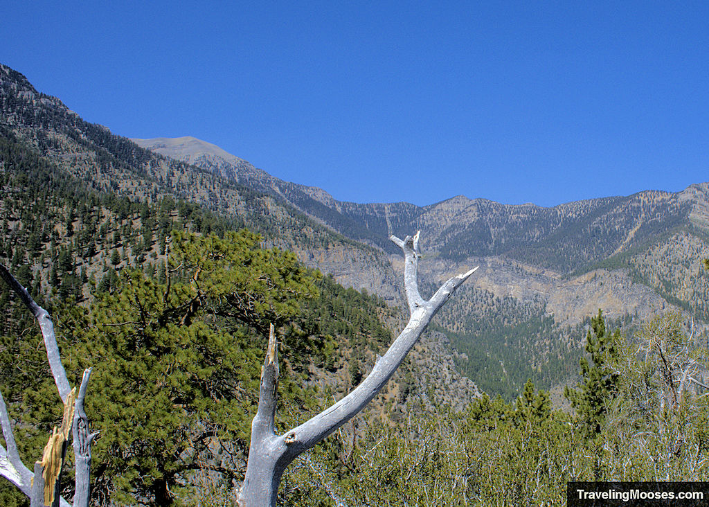
Clocking in at 11,916 feet above sea level, Mt. Charleston Peak is an epic alpine hike located near Las Vegas, NV. The hike boasts views of a 3,000-year-old bristlecone called the Raintree, beautiful views of the Spring Mountains and seasonal wildflowers.
The peak is accessible starting at the North Loop trailhead or can be accessed at the more popular South Loop trailhead. It is also possible to do a loop if you leave vehicles at each trailhead.
- Distance (round trip): ~20.6 miles
- Difficulty: Most Difficult
- Elevation gain: ~5,000 feet
- Route Type: Out and back
- Average time: 10 -12 hours
- Trail start: North Loop Trailhead
- Best Used: June – September
Raintree Trail
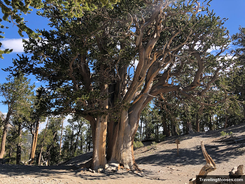
The Raintree trail is a popular 2.7-mile trek (each way) that takes hikers through scenic forests, past epic views and culminates in what many believe to be the oldest living thing in Nevada, a 3,000-year-old massive bristlecone tree.
- Distance (round trip): ~5.4 miles
- Difficulty: Moderate/Hard
- Elevation gain: ~1,650 feet
- Route Type: Out and back
- Average time: 3.5 hours
- Trail start: North Loop Trailhead
- Best Used: Late Spring – Early Fall
Related: Read more about our experience on the Raintree Trail.
Mummy Spring Trail
Mummy Spring is located around 0.3 miles from the famous Raintree and about 3.0 miles from the North Loop Trailhead. The spring flows year-round, although it’s typically a trickle in the summer months. Hikers will enjoy a variety of foliage and seasonal wildflowers surrounding the spring, along with grand views of the Vegas Valley.
- Distance (round trip): ~6.0 miles
- Difficulty: Moderate/Hard
- Elevation gain: ~1,800 feet
- Route Type: Out and back
- Average time: 4.0 hours
- Trail start: North Loop Trailhead
- Best Used: Late Spring – Early Fall
Fletcher Peak
The Fletcher Peak trail reaches an elevation of 10,319 feet, and boasts scenic views of Mt. Charleston Peak, Mummy’s Toe and Cockscomb Ridge. Many hikers will also take a slight detour to visit the famous Raintree.
- Distance (round trip): ~7.3 miles
- Difficulty: Moderate/Hard
- Elevation gain: ~2,300 feet
- Route Type: Out and back
- Average time: 4.5 hours
- Trail start: North Loop Trailhead
- Best Used: May – October
Related: Read more about our experience summiting Fletcher Peak.
Getting to the North Loop Trailhead
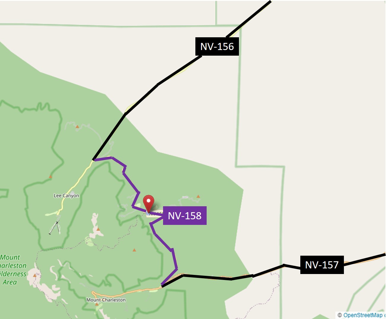
The North Loop Trailhead can be found off of Highway NV-158 (aka Deer Creek Road) about 4.8 miles from the NV-157 / Kyle Canyon turn off.
From Las Vegas:
Take Highway 95 Northbound until you reach Exit 96 (Kyle Canyon / NV 157 / Sunstone Pkwy). Turn left off the exit onto NV-157 / Kyle Canyon Road. Drive approximately 16 miles and turn right on NV-158. Continue approximately 4.8 miles up NV-158 and you’ll see the parking area for the North Loop Trailhead on the left-hand side of the road.
It’s tempting to speed on NV-157 & NV-158. We highly recommend against this. We frequently see police cars driving around Mt. Charleston and bikers / hikers are often on the narrow shoulders or crossing the highways at various trailheads.
Parking at the North Loop Trailhead
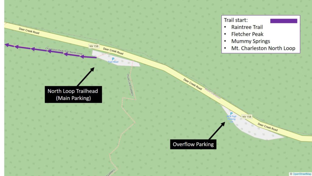
The parking areas are popular and fill up quickly. The main area holds about 15 vehicles, depending on how closely they’ve parked to each other (there are no striped lines).
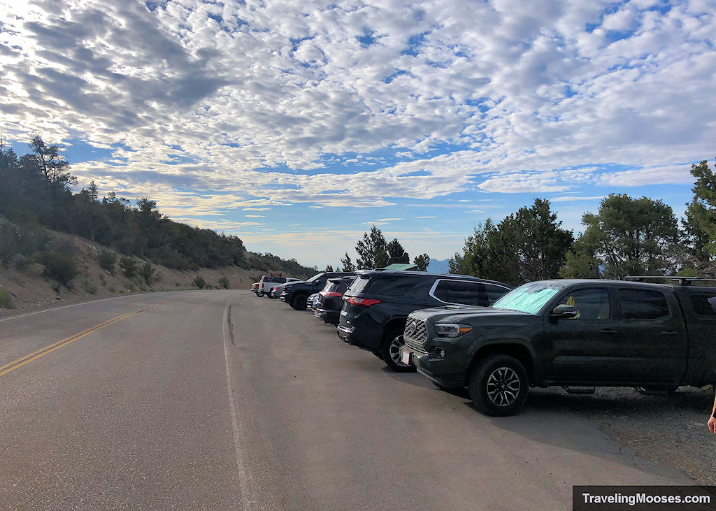
You’ll want to go early to snag a spot at the actual trailhead. If you have to park at the overflow lot, it will require walking up NV-158 on a narrow shoulder.
The overflow area is also the start of the popular Shoots and Ladder mountain biking trail.
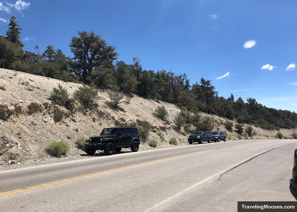
We did see some creative parking by various vehicles, including cars parking along the shoulder. We didn’t see any signs restricting this behavior, but we recommend against it as it’s very narrow.
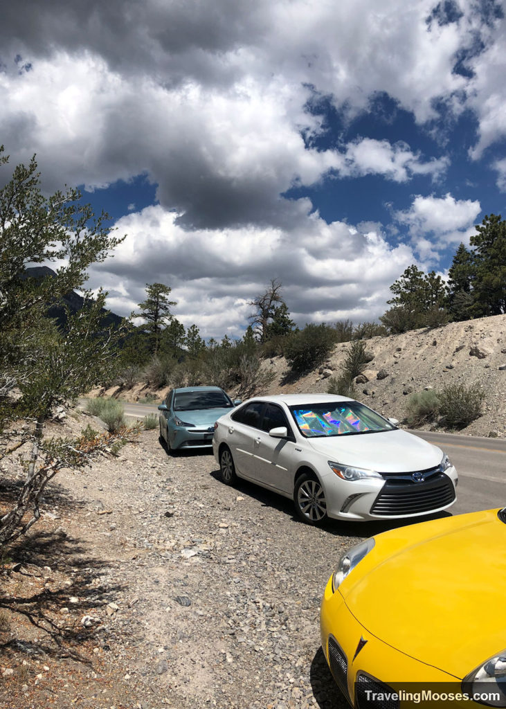
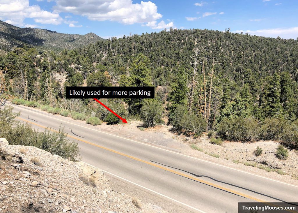
If you can back into the spot when you arrive, you’ll have an easier time leaving, especially when the roads are busy. The parking area is so small, we had to back out into NV-158 to leave. This was a little nerve racking as there are several blind corners on the road and while the speed limit is 40 mph, many drivers do not obey these limits. Use caution.
North Loop Trailhead Amenities
- One main parking area with an overflow lot down the road.
- Hiking boot brush
- Trail information and trail map
- Access to several different trails, Raintree (5.4 miles round trip), Fletcher Peak (7.3 miles round trip), North Loop Charleston Peak (20.6 miles round trip), Mummy Springs (6.0 miles round trip). The North Loop trail also has a junction to Trail Canyon and Wildhorse Canyon trails.
- Nearby to the Hilltop and Mahogany Grove Group Campgrounds.
Trail Rules
A few rules exist along the trail as posted on the information sign boards at the trailhead:
- No overnight camping is allowed.
- No campfires or charcoal grills are allowed due to fire restrictions. Stoves are ok to use.
- If you pack it in, pack it out. Do not leave trash in the wilderness area.
- Stay on the trails. Cutting switchbacks impacts the integrity of the trail and creates erosion.
- Non-denotated explosives are used for avalanche control in the area. If you find one, do not touch it, and call the U.S. Forest Service or Lee Canyon Ski Area for removal.

