
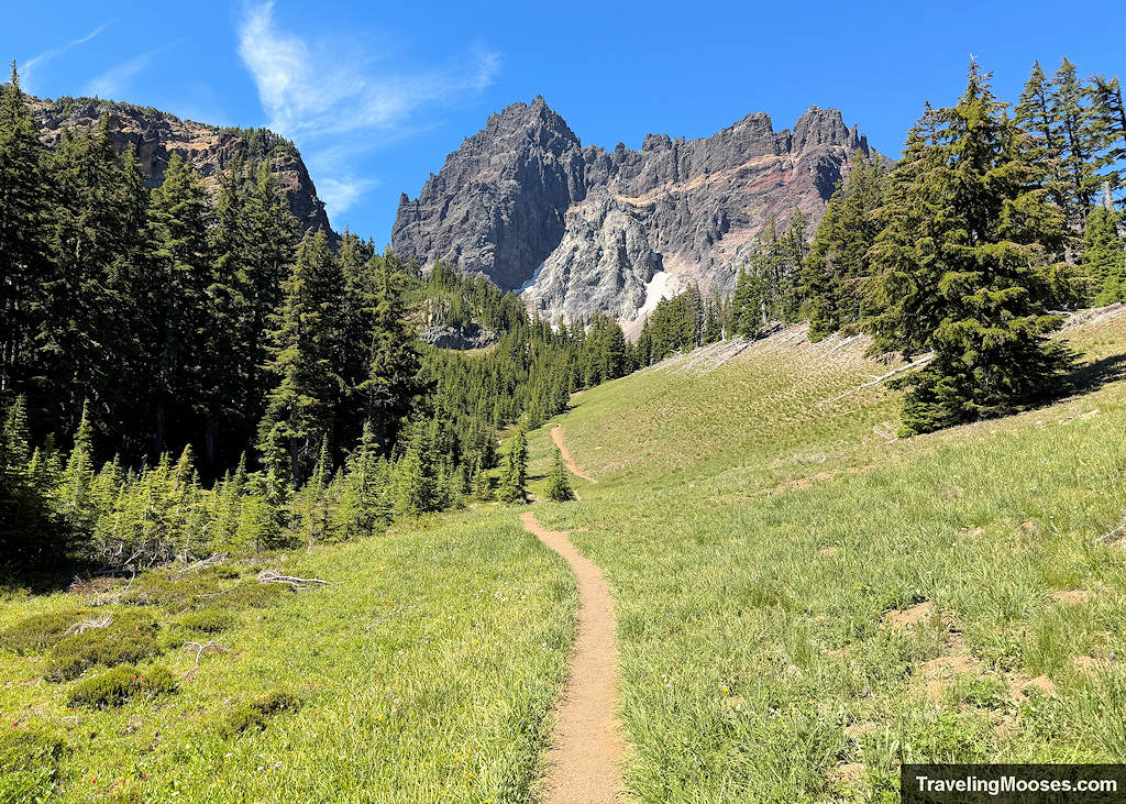
Central Oregon is absurdly scenic, but internet guides treat every trail like a can’t-miss bucket-list masterpiece. The reality? Time is limited, parking is brutal, and one flat stretch of pine trees looks just like the next.
We ruthlessly cut hikes by building a value-chasing decision tool to make every minute on the trail count.

How These Hikes Were Chosen
There are over 2,000 miles of trails in the surrounding Deschutes National Forest in and around Bend. With limited time, we couldn’t just pick random trails off a map, we had to thoroughly research our options.
To make the cut, a trail had to meet three core criteria:
- Length and Elevation as a Crowd Minimizer: We deliberately favored longer routes and bigger climbs. Difficulty is the single best way to leave 90% of the crowds behind (plus, who doesn’t want a good workout?).
- Visual Payoff: We compared terrain and photos across dozens of hikes to eliminate duplicate scenery. If two trails offered the exact same view, forest type, or lake backdrop, we cut the lesser version. Every hike on this list offers a unique, high-payoff visual to justify your effort and if one fell short, we’ll call it out.
- Waterfalls: Living in Las Vegas, waterfalls are a luxury, if they are available, we’re going to go see them.
- Uniqueness: We made exceptions for highly coveted, location-specific features. Spots like Tumalo Falls, Pilot Butte, or Lava River Cave are essential visits, regardless of the crowds or logistics required to pull them off.
1. Hikes We Completed
High-Alpine Trails (Where mileage and permits ditch the crowds)

- South Sister ~12.4 mi | 5,000 ft gain: The ultimate legs-and-lung burner. A relentless slog up scree and red cinder, but the summit crater and 360-degree high-alpine payoff are unmatched.
- Tam McArthur Rim to No Name Lake / Broken Top ~11.5 mi | 2,400 ft gain: Starting at Tam McArthur offers immediate high elevation viewpoints and continuing out toward No Name Lake delivers a surreal turquoise glacial water experience.
- Green Lakes Loop Trail ~12.5 mi | 1,800 ft gain: A well-established, steady climb following Fall Creek up through alpine meadows filled with wildflowers, past bubbling water, and right into the basin between South Sister and Broken Top.
- Three Fingered Jack (Loop / Pass) ~11.5 mi, 2,100 ft gain: Sheer, jagged, and wild. This hike packs in dramatic, rugged rock spires, glacial ponds, and a great chance to spot mountain goats scrambling along the ridges.
- Obsidian Trail ~12.0 mi | 2,000 ft gain: Sweeping mountain views, a gorgeous cascading waterfall, and paths through glittering volcanic rock. This wilderness loop has a little something of everything.
- Mt. Bachelor (no permit needed) ~6.5 mi | 2,760 ft: A serious vertical climb up the cinder cone that rewards you with sweeping, unobstructed views of the Cascade chain and far fewer people despite the lack of permit.
Volcanic Landscapes & High Desert

- Misery Ridge Loop (Smith Rock State Park) ~2.6 mi, 1,110 ft gain: A steep, relentless burn up switchbacks right out of the gate, but worth every step. The top-down views of the Crooked River winding through the gorge and watching rock climbers scale the rocky faces make this an absolute high-desert essential.
- Big Obsidian Flow (Newberry Caldera) ~1.0 mi | 200 ft gain: Walking across fields of black glass, the Big Obsidian Flow at Paulina Lake is a short, punchy trail with views of the caldera lake and seasonal migrations of tiny frogs (yes, actual frogs hopping across raw lava rock).
- Dee Wright Observatory Discovery Trail ~0.5 mi | 40 ft gain: Located at McKenzie Pass, this surreal landscape features endless black lava fields with a historic stone observatory framing amazing views of the Three Sisters.
- Fort Rock Loop ~1.6 mi, 200 ft gain: A massive, isolated volcanic tuff ring rising straight out of the high-desert sagebrush.
- Lava Butte ~3.5 mi, 500 ft gain: An expansive, towering cinder cone offering elevated views looking out over the surrounding lava fields, Newberry Caldera, and the distant Cascade peaks.
- Lava River Cave ~2.2 mi, 150 ft gain: A massive, pitch-black underground volcanic tube that lets you walk over a mile beneath the earth through ancient lava pathways.
Waterfalls & Rim Views
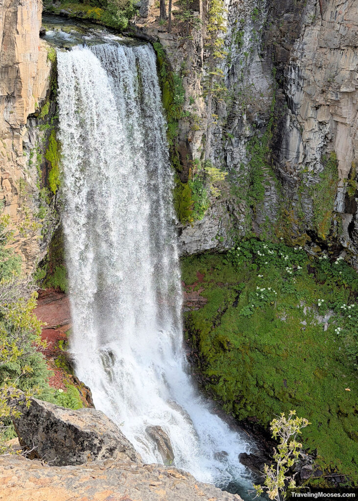
- Tumalo Falls Loop ~6.5 mi | 800 ft gain: The classic 89-foot plunge right outside town. It’s incredibly busy near the trailhead, but if you keep traveling upstream, the crowds thin and you hit several spectacular upper waterfalls.
- Read more about Tumalo Falls.
- Paulina Falls ~0.5 mi | 100 ft gain: Twin side-by-side waterfalls spilling over 80-foot basalt cliffs right inside the Paulina Caldera.
- Read more about Paulina Falls
- Tamolitch Falls (Blue Pool) ~4.2 mi | 350 ft gain: A neon-blue spring water bubbling out of a dry lava bed on the McKenzie River. The waterfall is seasonal.
- Read more about Tamolitch Falls (Blue Pool)
- Toketee Falls ~1.0 mi | 170 ft gain and Watson Falls ~2.4 mi | 430 ft gain: A fantastic day trip double-header down in the Umpqua corridor. Toketee frames a two-tiered drop neatly set in precise basalt columns, while Watson is a towering, misty 272-foot sheer drop.
- Read more about Toketee Falls and Watson Falls.
- Garfield Peak ~3.4 mi | 1,000 ft gain and Watchman Peak ~1.6 mi | 420 ft gain (Crater Lake): Garfield gives you a solid, continuous climb along the rim away from the paved pullouts. Watchman Peak switchbacks up to an old fire lookout for the single best top-down view of Wizard Island.
Quick Connectors & Overlooks

- Deschutes River Trail (Old Mill District to Drake Park) ~3.0 mi, 50 ft gain: A scenic, paved/dirt riverwalk right through town. Perfect for a casual morning stroll or post-hike recovery walk to watch kayakers, floaters, and start your day along the river without driving to a trailhead.
- Vista Butte ~3.5 mi, 850 ft gain: A quick cinder cone hike right off Cascade Lakes Highway that delivers huge panoramic views of Broken Top and Mt. Bachelor without requiring a full-day commitment.
- Pilot Butte ~1.8 mi, 490 ft gain: Bend’s extinct urban cinder cone. The best way to get a bird’s-eye view of the city and proudly say you stood on the central landmark whenever you’re driving around town.
- Fall River Falls Viewpoint ~0.4 mi | 50 ft gain: Crystal-clear, spring-fed water winding along a peaceful, meandering trail framed by Ponderosa pines.
- Read more about Fall River Falls in La Pine State Park
- Big Pine ~0.6 mi, 20 ft gain: A massive, 500-year-old Ponderosa pine rising majestically out of a grove of ancient trees. This is a quick, impressive stop if you love giant trees like we do.
2. The Wish List (What We Missed & Why)

Even with a great plan, Central Oregon sometimes has other plans. Between road closures, smoky days during fire season, and simple time constraints, we couldn’t get to everything. These are high on our radar for next time:
- Metolius River Trail (Wizard Falls to Gushing Springs) ~5.8 mi | 150 ft gain: Cold, crystal-clear spring water gushing straight out of canyon walls. They also have a fish hatchery where you can feed the fish. We skipped this after running out of energy at Tamolitch Falls (Blue Pool) and Clear Lake. Plus, turning left back onto the highway without a light in heavy traffic that day was a hard pass.
- Proxy Falls Loop ~1.6 mi, 140 ft gain: A famous, veil-like waterfall cascading down mossy lava rock. We skipped it for two reasons: we ran out of time, and we really didn’t want to drive back past Dee Wright Observatory again. That road is windy, narrow, and slow.
- Alder Springs and Crooked River Gorge ~7.0 mi, 850 ft gain: Deep, isolated high-desert canyons with dramatic rock walls and river crossings. We had to pass on this due to time constraints and smoke in the area.
- Black Butte ~4.0 mi | 1,600 ft gain and Coffin Mountain ~4.0 mi | 1,000 ft gain: Incredible summit fire lookouts with 360-degree views and seasonal wildflower meadows. Black Butte’s trail was closed due to nearby fires, and we simply ran out of time for Coffin Mountain.
- Maxwell Butte: A solid, high-reward mountain grind that was high on the list, but ultimately got bumped due to time.
- Canyon Creek to Mount Washington Overlook: A great option for dramatic mountain views; top of the backup list if time allows, but easy to skip if the schedule is packed.
- Gray Butte: Looks decent for central views, but pretty average overall, a “nice to have if you’re bored,” not a top-tier priority.
- Patjens Lake Loop: A pleasant, straightforward lake circuit that’s perfectly fine, but easily skippable if you’re prioritizing higher-payoff trails.
3. Hikes we intentionally said no to
Time is limited, and being able to say “no” to a hike is just as important as saying “yes.” Here is why certain popular or heavily searched trails got dropped from our itinerary:

Better Alternatives Available
- Tumalo Mountain ~4.0 mi | 1,400 ft gain and Black Crater ~7.2 mi | 2,500 ft gain → Cut for Mt. Bachelor & South Sister
- Tumalo Mountain is essentially the “younger cousin” to Mt. Bachelor. If you’re doing Bachelor or South Sister, Tumalo Mountain and Black Crater become completely redundant. (Side note: Due to fires and smoke during our trip, Tumalo almost made an appearance, but we woke up too late for a parking spot and opted for Vista Butte instead.)
- Maiden Peak ~11.6 mi | 2,800 ft gain and Six Lakes Trail (to Blow Lake & Doris Lake) ~8.0 mi | 600 ft gain → Cut for Three Fingered Jack & Green Lakes
- Standard pine-and-lake trails look pleasant on paper, but the rugged spires of Three Fingered Jack and the alpine basin at Green Lakes looked far more appealing in photos.
- Steelhead Falls ~1.0 mi | 150 ft gain → Cut for Chush Falls
- Steelhead has nice desert canyon cliffs, but Chush Falls offers a significantly more dramatic cascade and canyon payoff.
- Deschutes River Trail (Benham to Slough/Dillon) ~6.8 mi | 200 ft gain → Cut for In-Town River Walks & High-Alpine Hikes
- While the whitewater sections near Benham Falls are pretty (which we saw on our Sunriver bike day), we opted for the paved Old Mill District stretch of the Deschutes River Trail right in town instead. When it came to wilderness hiking time, flat riverside singletrack got sacrificed for high-elevation alpine views.
- Riley Ranch to Shelvin Park ~6.0 mi | 250 ft gain: A long connector that feels pretty “meh” compared to the more scenic river stretches closer to town.
- Upper Three Creek to Sno-Park to Jefferson View Shelter ~4.0 mi | 400 ft gain: This was a forum recommendation that looked better in the winter than the summer.
- Willow Springs Preserve ~1.5 mi | 30 ft gain: Another random internet find that looks fine for locals walking a dog, but completely skippable for an unforgettable adventure in alpine territory.
- Jasper Point (Prineville Resort) ~1.5 mi | 100 ft gain: Zero reason to go out of your way for this unless you happen to be camping right at the reservoir and looking to kill an hour.
- Edison Butte ~5.5 mi | 500 ft gain: Doesn’t really make sense as a summer hiking objective when far superior high-desert and volcanic trails are right next door.
Conditions, Closures & Technical Hazards
- Horse Butte to Boyd Cave Loop ~6.8 mi | 300 ft gain: We really wanted to visit more caves during our time in Bend, but the area was closed for rehabilitation when we visited.
- Skyline Forest: This was once a popular area, but it is now private property and closed to public access.
- Blue Basin Overlook Trail ~3.2 mi | 760 ft gain: Closed due to major mudslide damage.
- Mount Thielsen ~9.2 mi | 3,800 ft gain: An incredible peak, but the final 80-foot summit pitch requires an exposed Class 3/4 rock scramble up a jagged spire. We aren’t comfortable with high exposure so it came off the list.
- Belknap Crater ~12.6 mi | 1,700 ft gain: A shade-less slog across endless fields of black and red volcanic cinder. Unique, but we felt Obsidian Trail was a better match for what we were looking for.
- Oregon Badlands Wilderness (Flatiron Rock to Ancient Juniper) ~6.5 mi | 150 ft gain: Way too much exposed, flat desert terrain when Central Oregon offers far better volcanic and alpine features. We came for trees, lakes and mountains, not our desert hometown landscapes.
4. Hikes & Stops We Wish We Had Skipped (Or Could Take or Leave)
Just as important as knowing what got cut before the trip is knowing which “must-do” stops didn’t quite deliver once our feet were on the ground.
- Tamolitch Falls (Blue Pool):
- Why It’s Skippable: The neon-blue pool is famous, but as an overall experience, we’d skip it if we could go back in time. Between the long drive out to the McKenzie Highway, the crowded trails, the lack of falls, and heavy shadows on the pool itself, it just wasn’t worth the hassle. (Read the full rant on Tamolitch if you want the unfiltered breakdown).

- Fall River Falls Viewpoint:
- Why It’s Skippable: It’s a peaceful stretch of water through the pines, but if you’re already doing river walks in town or higher-payoff waterfall trails, this one is an easy cut as it’s far off the beaten path. If you bring some foldable chairs, a lunch and your swim suit, you could easily add it back in.
- Vista Butte:
- Why It’s Skippable: A quick cinder cone hike with nice views of Broken Top and Bachelor, but visually average compared to the heavy hitters. (The caveat: It served a purpose for us as a light activity when smoke from nearby fires forced us to scale back our plans.)
- Fort Rock:
- Why It’s Borderline: It is a very long drive out into the high desert for a single geological feature. If you only drive out for the rock formation itself, you might regret the mileage. However, stopping by the nearby Fort Rock Valley Historical Homestead Museum made the long haul out there feel worth it for us. Note: we also visited hole in the ground on the same day trip, we’d recommend skipping that too.
A quick note on two popular spots that actually passed the test for us: We walked up Lava Butte instead of taking the shuttle, which made it free and gave it a solid workout feel. And despite being right off the highway, Dee Wright Observatory delivered such a surreal, moonscape view of the Three Sisters that it earned its place. Plus, if you go out towards Obisidian or Proxy Falls, you’re going to drive right past Dee Wright anyway.
What to Know Before You Go
If you’re heading out to recreate in Central Oregon, keep these three practical realities in mind:
- The Permit System: The Central Cascades Wilderness Permit System applies to popular trailheads (including South Sister, Green Lakes, Broken Top and others) from mid-June through mid-October. Overnight and day-use permits drop in two waves on Recreation.gov (10 days in advance and 2 days in advance at 7:00 AM PST). Lock these down before you build your daily schedule.
- High Desert Altitude & Hydration: Bend sits at ~3,600 feet, and the mountain summits push well above 9,000 feet. Combined with dry desert air and zero shade on exposed cinder fields, you will burn through water fast.
- Fire Season Flexibility: Late summer in Oregon means wildfire season. Keep a backup list of lower-elevation or high-desert options (like Fort Rock or town river walks) in your back pocket in case smoke or active fires close your primary mountain trails.

Final Thoughts
At the end of the day, Central Oregon is too big to see everything in one trip. Don’t waste your energy chasing someone else’s generic checklist. Focus on the trails that match your fitness level, prioritize unique views over duplicate pine forests, and don’t be afraid to pull the plug on a hike if effort doesn’t match the payoff.
Have fun out there, enjoy the Cascades, and happy hiking!