
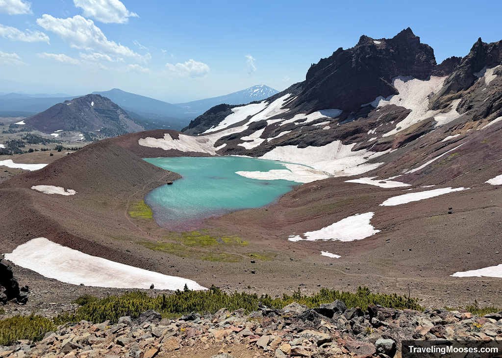
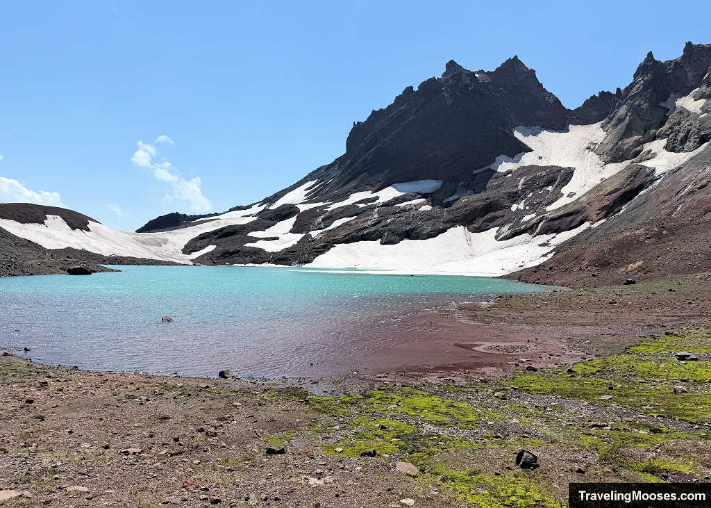
No Name Lake should be on every hiker’s bucket list when visiting Bend, but accessing this glacial tarn isn’t straightforward. Our route started at Three Creek Lake, climbed to Tam McArthur Rim, traversed the jagged spine of Broken Hand, and dropped down the high ridge directly to the No Name Lake shore.
Why Choose the Tam McArthur Approach to No Name Lake? (Route Comparison)
If you are researching No Name Lake, you will inevitably see three different starting options:

1. No Name via Broken Top Trailhead or Crater Ditch Trailhead (FR 370 / 380):
- The Appeal: From Broken Top this is the shortest path at roughly 5.5 miles round trip (or from Crater Ditch, 8 miles). This was our original preferred plan.
- The Reality: The access road requires true high-clearance 4WD, heavy-duty all-terrain tires, and a highly competitive wilderness permit. We had the high clearance, but our tires were suspect. In fact, permits are so competitive that hikers reserve them before the winter snowpack even melts off the road on the off chance it opens early.
- Road Conditions: When the road finally opened in early July, recent AllTrails reviews confirmed our hesitation, with one driver warning: “We drove in a Subaru Outback, and honestly did pop a tire. I would not drive unless you have newer tires/lots of clearance.” If you don’t want to risk vehicle damage, rule this route out.
- Recent Road Opening Dates: For context on why July trips rarely work via FR 370, look at the historical gate opening dates:
- 2026: July 8 (an exceptionally dry year—hopefully not a permanent trend)
- 2025: August 8
- 2024: July 30
- 2023: August 1
- 2020: July 29
- 2019: August 2
2. No Name Lake via Todd Lake Trailhead:
- The Appeal: Located directly off the paved Cascade Lakes Scenic Byway, Todd Lake offers easy passenger car access.
- The Trade-off: It turns the hike into a long 13 to 14-mile day, with the first several miles spent on a gradual, viewless walk through dense forest.
- Permit Competition: Todd Lake and neighboring Green Lakes are among the most heavily contested permit lotteries in the entire Central Cascades system. We checked availability multiple times and never saw a single opening. Plus, after recently tackling the Green Lakes loop, we weren’t eager to tack on extra flat forest mileage.
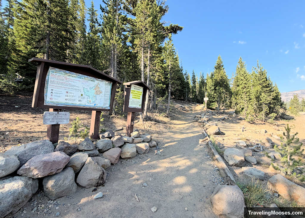
3. No Name via Tam McArthur Rim (Three Creek Lake):
- The Appeal: Starting from Three Creek Lake keeps the hiking distance to a manageable 11.5 miles round trip while offering views of the Cascade peaks almost immediately.
- The Trade-off: The drive requires navigating two miles of washboard gravel, but standard passenger cars can manage it just fine (at least in the summer). You trade the boring forest miles of Todd Lake and the axle-busting boulders of FR 370 for an alpine ridge walk.
- The Catch: Pushing past the official rim overlook toward Broken Hand and No Name Lake enters unmaintained alpine terrain featuring loose volcanic scree, route-finding, and cliffside exposure.
Getting to Tam McArthur Trailhead and Parking Realities
The trailhead sits at Three Creek Lake, roughly 16 miles south of Sisters. Take Elm Street south out of town as it transitions into Three Creek Road (Forest Road 16). Downloading an offline map beforehand is essential, as cell service drops out shortly after leaving Sisters.
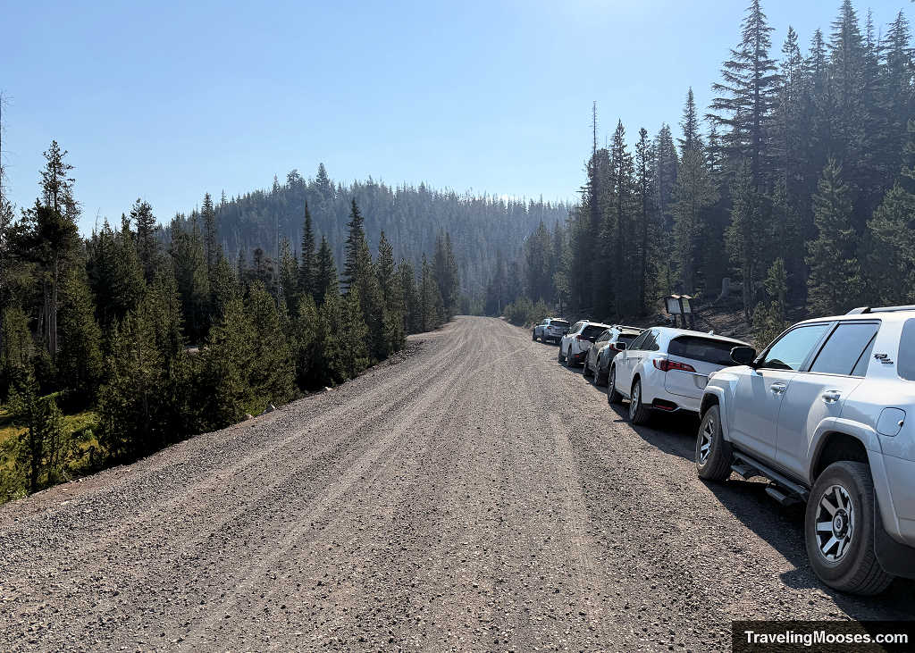
- The Road: The first 14 miles are smooth pavement. The final two miles turn into an unpaved, washboard dirt and gravel road. While it seemed narrower than a normal two-lane road, there is plenty of room to pass oncoming cars. A standard passenger sedan can easily handle the drive, though higher clearance makes the drive more tolerable.
- The Parking Trap: Arriving by 8:30 AM on a Thursday, cars were already lined up along the gravel shoulders of the road. Naturally, we assumed the day-use lot was full and parked on the shoulder, too. Only upon finishing the hike did we realize there was an official designated day-use parking lot located before that roadside lineup. It had plenty of open, easy spaces that drivers simply missed. Keep your eyes peeled for the actual parking turn-off on your way in before settling for a dusty pull-off on the road.
- Passes Required: A Northwest Forest Pass or America the Beautiful interagency pass must be displayed on your vehicle dashboard. There is no automated kiosk or pay station onsite to purchase one, so buy and print your pass before leaving town.
Wilderness Permits and Weather Considerations
This hike falls within the Central Cascades Wilderness Permit System (Three Creek Lake Trailhead) for day use between mid-June and mid-October.
Compared to high-demand permits like Green Lakes or South Sister, Three Creek Lake is generally one of the easier permits to obtain on Recreation.gov. We actually rescheduled ours twice.
Timing Tip: If your goal is reaching No Name Lake, waiting until later in the summer gives the snowfields clinging to the north side of Broken Hand time to melt out. Even in a low snowpack year, lingering snow on that high traverse turns a spicy walk into a dangerous slide risk without traction.
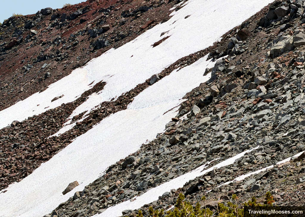
Weather Warning: While you can plan around snowmelt, do not overlook the wind. Checking wind speeds before heading out is critical. The winds really picked up the day we visited along the rim above No Name Lake, making the exposed sections feel much more intense.
Essential Gear
In addition to the Ten Essentials, pack these specific items for this route:
- Sturdy boots with good tread: Essential for traction on loose, sliding scree.
- Trekking poles: Vital for stability on the crumbly slopes and steep descents.
- Wind layers or a shell: Crucial for handling high, biting gusts once exposed along the high rim.
- Hair ties, buff, or hat clips: Keeps loose hair from whipping across your eyes and prevents caps from blowing off the knife-edge ridges.
- Offline GPS track or navigation app: Necessary for route-finding once the user tread fades around Broken Hand.
- Ample water and electrolytes: You are fully exposed above tree line for miles, with zero water sources to filter until you hit the lake.
Hiking from Tam McArthur to No Name Lake via Broken Hand
| Metric | Tam McArthur Rim (Official Overlook) | Tam McArthur to No Name Lake Via Broken Hand |
| Distance (RT) | ~5.2 miles | ~11.5 to 12.0 miles |
| Elevation Gain | ~1,300 ft | ~2,400 ft |
| Difficulty | Moderate | Strenuous |
| Trail Type | Maintained USFS singletrack | Unmaintained trail transitioning to alpine user path |
Section 1: The Climb to Tam McArthur Rim Overlook (Miles 0 – 2.6)
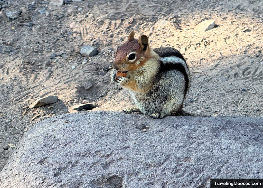
Before we even stepped onto the trail, we were greeted by a cheeky golden-mantled ground squirrel posing proudly on a boulder near the trailhead (and no, we didn’t feed him).
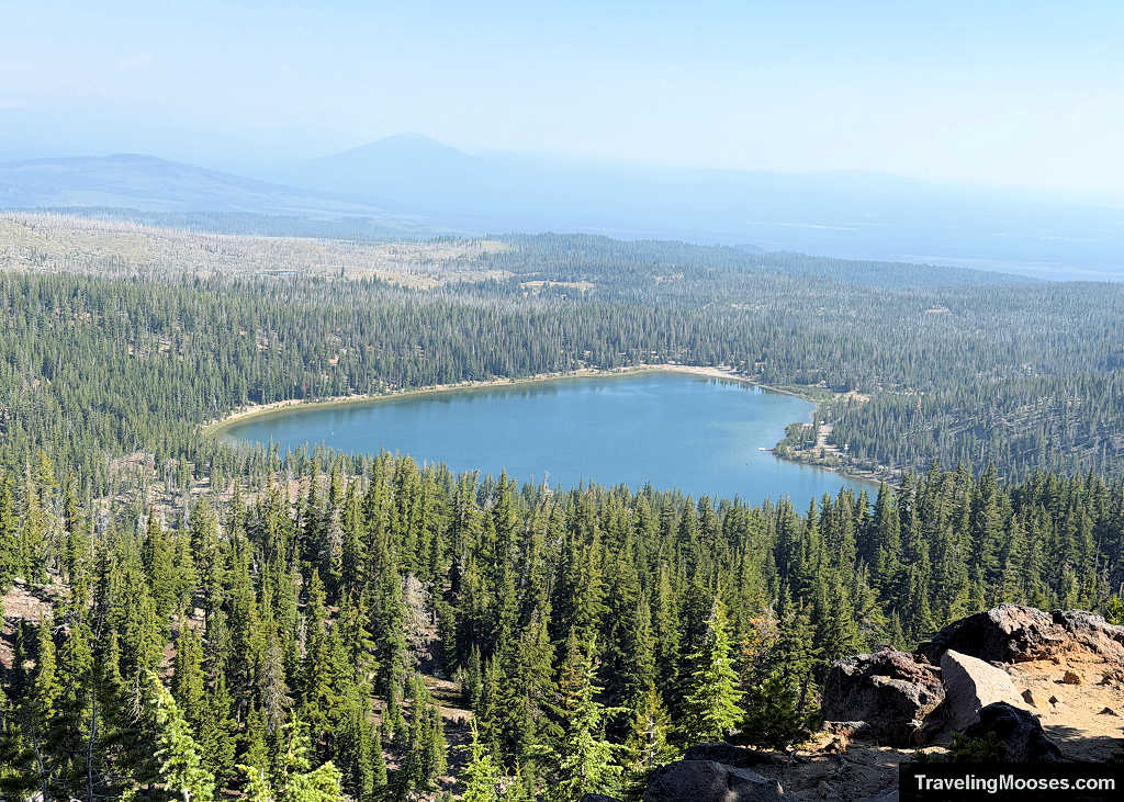
From the first steps away from Three Creek Lake, the trail wastes no time gaining elevation, settling into a steady uphill clip right out of the gate. Fortunately, the early miles wind through a well-shaded canopy of hemlocks and firs, with the dirt path cutting into a consistent series of switchbacks. As you climb, frequent breaks in the trees offer gorgeous glimpses down at Three Creek Lake, where morning fishing boats were already out on the water.
Eventually, the thick timber begins to thin into an open subalpine meadow before the trail kicks up a final hill toward the crest of the rim.
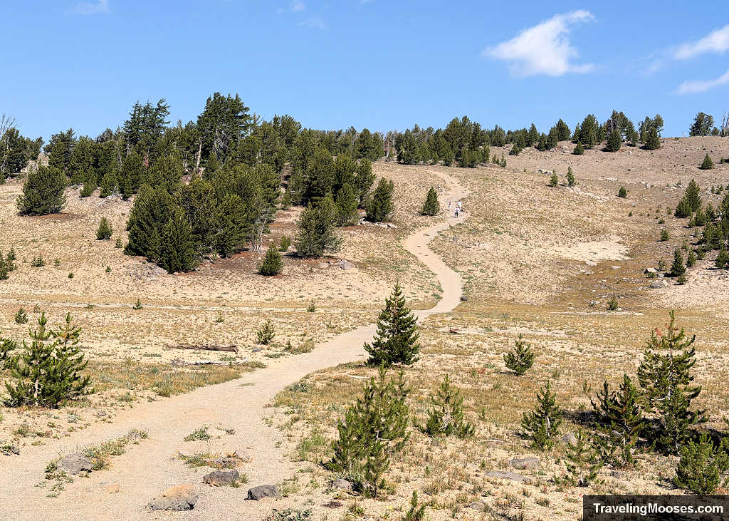
Much to our surprise, we found ourselves cruising past several slower hiking groups along this stretch. Weeks of tackling high-altitude hikes in Central Oregon had clearly paid off. As we would soon realize, we needed every bit of that cardio base for the unmaintained miles waiting beyond the rim. (Spoiler: the push all the way to No Name Lake easily ranks as the second-toughest day hike we completed in Bend, second only to South Sister).
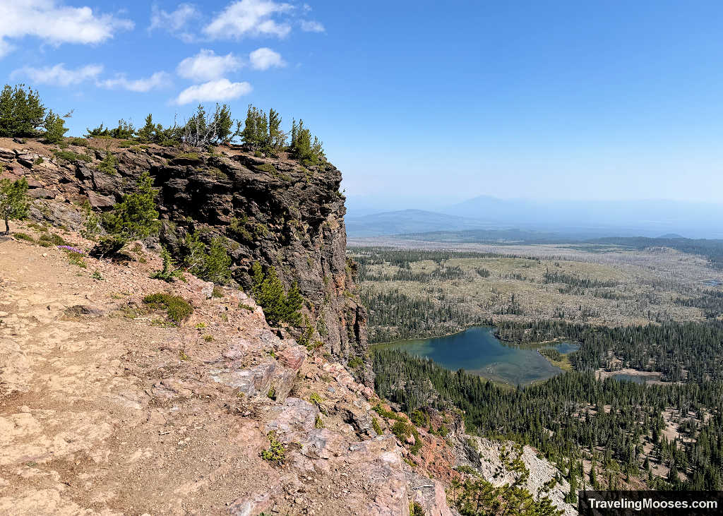
Around mile 2.6, you reach the official Tam McArthur Rim viewpoint at roughly 7,700 feet. The trail up to this point is official USFS singletrack. It’s wide, obvious, and exceptionally well-marked. We had the overlook entirely to ourselves for a short period before the next groups caught up.
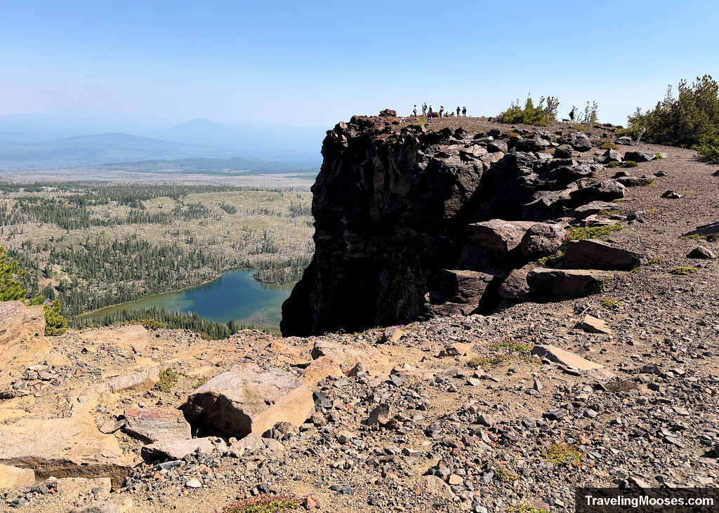
The panoramic view here is immense: Three Creek Lake sits directly below the sheer cliff face, with sweeping sightlines across the Cascade chain.
Tam McArthur Trail End and The Natural Turnaround Point
If you want a moderate half-day outing or aren’t comfortable with off-trail navigation, this is your spot to turn around. The 5.2-mile round trip to the rim and back is a classic, rewarding hike in its own right, and it is where the vast majority of trail traffic calls it a day.
If you are continuing on to Broken Hand and No Name Lake, take a quick breather, check your water supply, and get ready, the official trail is over and the unmaintained section is about to begin.
Section 2: Beyond Tam McArthur Rim to the Base of Broken Hand (Miles 2.6 – 4.2)
Leaving the viewpoint, the trail immediately skirts uncomfortably close to the rim edge. If you dislike sheer drop-offs, this stretch feels spicy right away, and I was already dreading having to retrace it on the return trip (and yes, the photo makes it look easy).
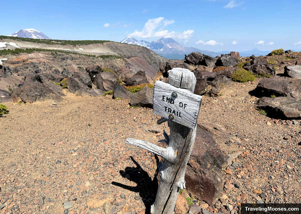
Shortly past the rim, you encounter an official sign marking the end of the maintained Forest Service trail. Despite the warning, the path across this open expanse remains remarkably clear and easy to follow.
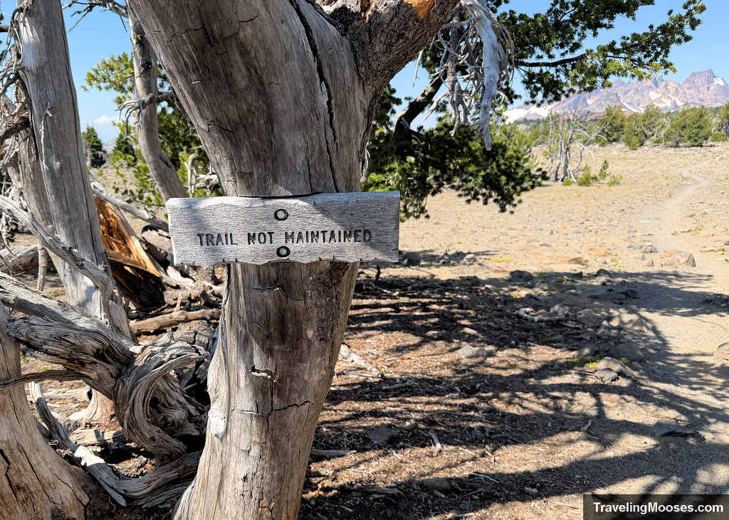
Large open fields stretch out in every direction, dotted with scattered volcanic boulders and rising at a gentle, steady uphill grade. In late summer conditions without snow cover, this unmaintained section felt just as well-trodden and distinct as the official trail before it.
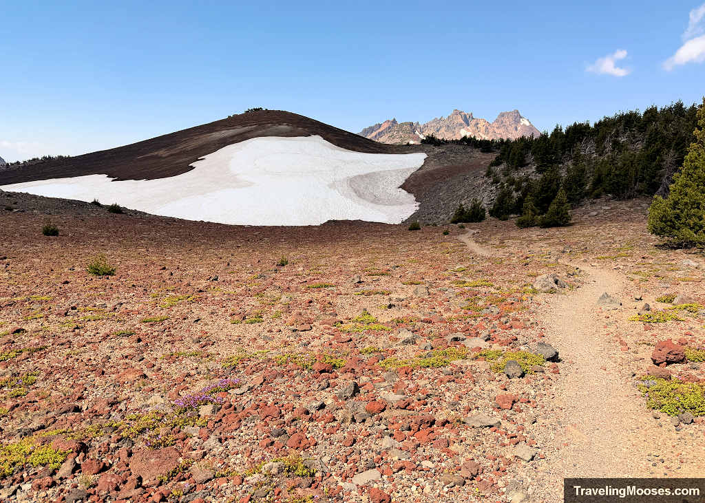
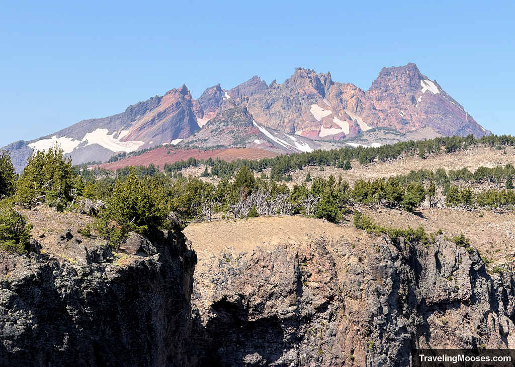
As you round a sweeping corner, the landscape opens up dramatically. You get your first clear look at the Sisters alongside views of Broken Hand rising in the distance, with a large snowfield still stubbornly clinging to the slope below the ridge.
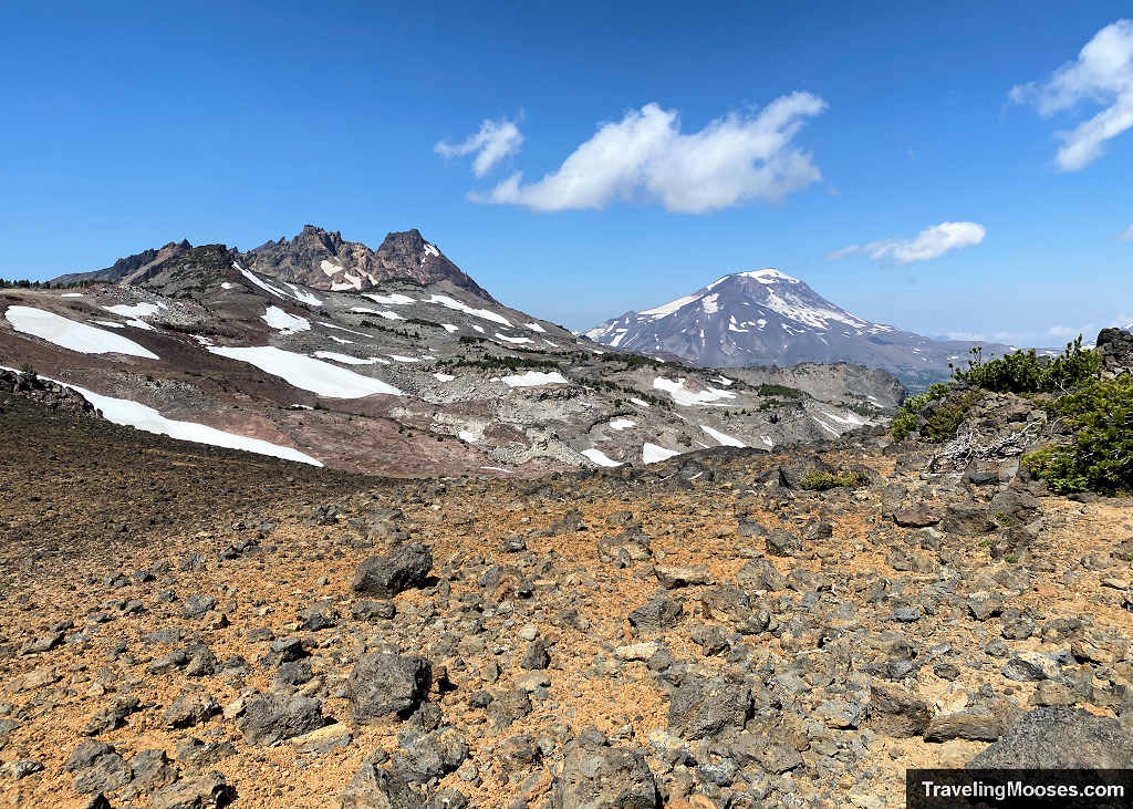
Around this point, the ground shifts from light pumice dust into deep red, crumbly volcanic rock. While trekking poles aren’t strictly necessary here, pulling them out made climbing the loose red cinder much easier.
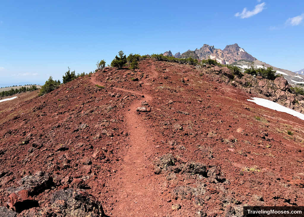
Before reaching the base of Broken Hand, you will hit a slightly awkward boulder pile where the path briefly disappears. Scrambling through the rock with trekking poles in hand felt clunky, but it is short-lived and has no concerning drop-offs or exposure. Once past that pile, the dirt track reappears, leading straight to the base of Broken Hand where the real “fun” begins.
Section 3: The Broken Hand Traverse: Where Most People Turn Around (Miles 4.2 – 5.0)
Reaching the base of Broken Hand makes it immediately obvious why so many hikers pull the plug. Trail choices become confusing, and the terrain deteriorates into steep, crumbly red volcanic scree across an exposed mountain pitch.
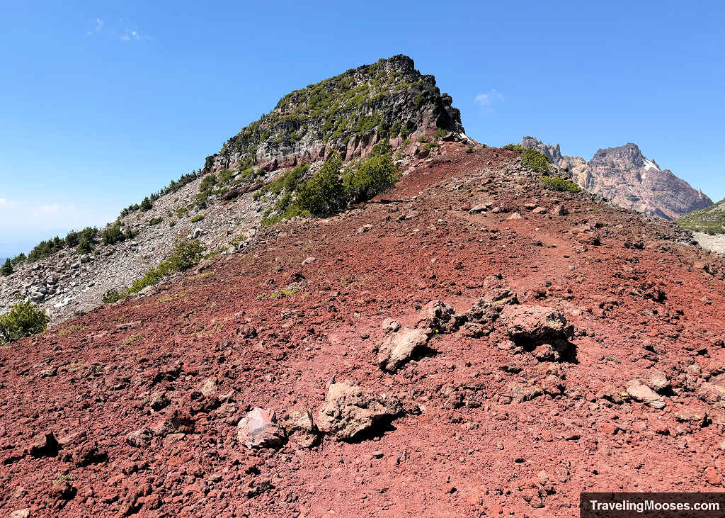
As we approached Broken Hand, the main path appeared to continue straight toward the rock face, but the route was deliberately blocked off with a pile of rocks. A very faint path branched off to the right, contouring down the steep slope. Both options felt wrong. We initially took the right fork down through the red scree, but the tread rapidly vanished into loose, unstable dirt that felt genuinely unsafe. After checking our GPS line and confirming we were off-trail, we scrambled back up, bypassed the rock cairn block, and attempted to follow the track heading straight toward Broken Hand.
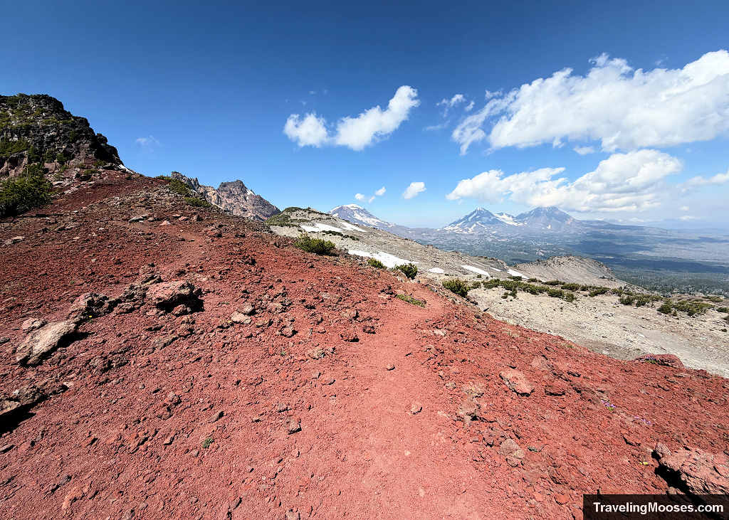
That didn’t work either. A short distance up, the path dead-ended into impassable rock. We needed to backtrack down the slope once more, ultimately traversing the “official” unmaintained user path mapped on AllTrails. My best advice for this section is simply to pick the friendliest line you can see based on current conditions (snow cover vs. bare scree).
Navigation Note: Online maps often suggest an alternate trail exists to the left (south) around Broken Hand. From our vantage point, contouring left looked like sheer cliff exposure and severe drop-offs. The right-hand line across the north-facing slope is the standard way through, but it requires slow, deliberate footing.
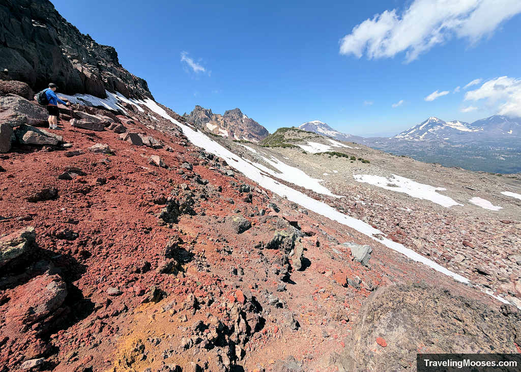
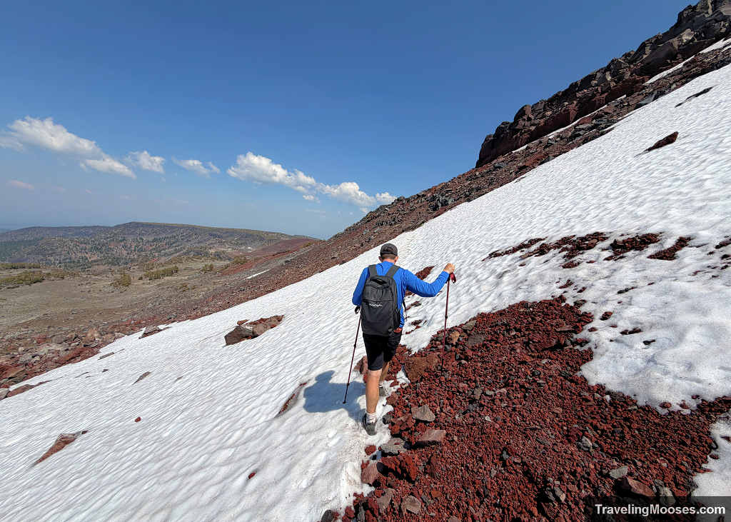
Negotiating this scree section was slow, methodical work, made trickier by lingering snow. While photos always flatten slope angles, in reality you are traversing steep, loose cinder interspersed with firm snowfields. The half-melted transitions between rotten snow and sliding dirt were by far the most challenging.
At one point, I got caught in a bind: my weight was pinned on my uphill back foot, while my forward right foot rested on unstable scree that threatened to slide out from under me. To take the next step, I had to transfer my entire body weight onto that slipping foot just to reach a narrow dirt shelf I trusted even less. My husband had to step in and use his boots to kick and carve a wider, stable step into the scree so I could finally commit my weight and move. Knowing we would have to retrace this exact slope on the descent was not fun.
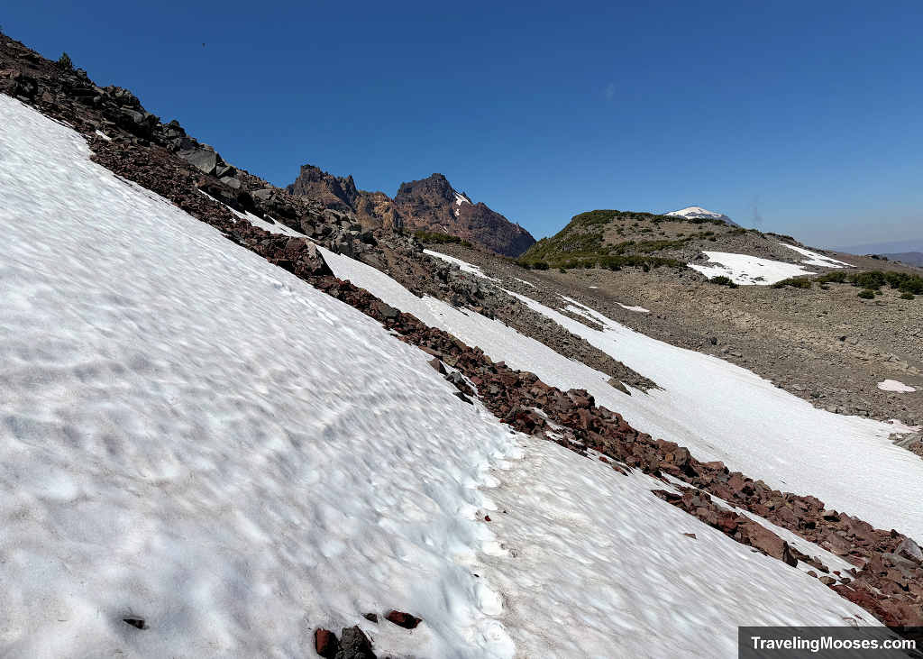
Interestingly, once we reached fully covered sections of the snowfield, the footing felt far more secure than the crumbly dirt-and-rock transitions. While inching across this slope, we watched two hikers who looked to be coming down from the summit of Broken Hand. They were picking their way down a sheer, bare rock face with zero ropes or technical gear, attempting to guide each other down the rock. Frankly, I am not sure exactly what they were doing, but watching them negotiate that crumbling rock with sheer exposure beneath them looked terrifying and only reinforced our decision to stay focused on the traverse.
The High Ridge Above No Name Lake
Because we were so focused on finding stable footing and avoiding sliding scree across that north face, we ended up hugging the slope high. As we cleared the corner of Broken Hand, we popped out high along a crest, staring directly down into the canyon below.
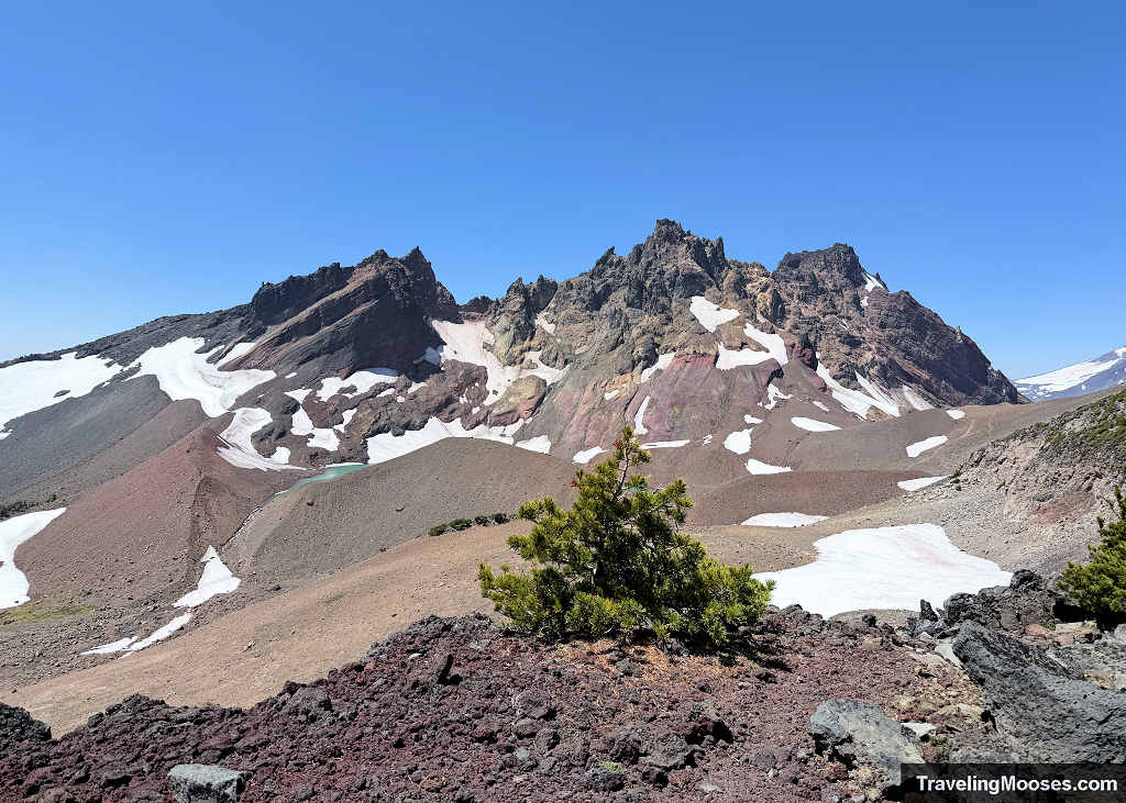
From this vantage point, looking down into the basin and realizing how far we still had to go was deflating. Far beneath us, we could see tiny hikers casually strolling along the wide, flat trail coming in from the Todd Lake approach along the creek. Meanwhile, we were standing on a steep, cliff edge, looking at what felt like an impassable drop, wondering if the lake was even worth it and trying to figure out where the trail went next.
We decided we needed to try.
Section 4: The Final Descent to No Name Lake (Miles 5.0 – 5.8)
Leaving that cliffside viewpoint at the base of Broken Hand, the work was far from over, and reaching No Name Lake was anything but a direct downhill cruise. To bypass the cliffs, the route forces you to contour around the basin.
First, you drop down into a boulder-strewn flat area where the trail essentially vanishes into a maze of broken volcanic rock. We did our best to follow the dotted line on AllTrails, backtracking a few times to weave together a passable, safe line through the boulders.
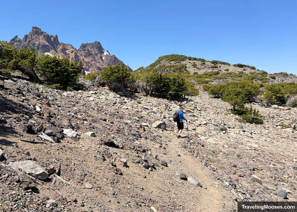
Once through the dip, you immediately face another uphill jaunt: climbing up and over a rocky, brush-covered shoulder sitting right around 8,200 feet. We climbed a steep, loose pitch that required careful foot placement and immediately triggered dread about having to descend it on the return trip. Trekking poles were non-negotiable here.
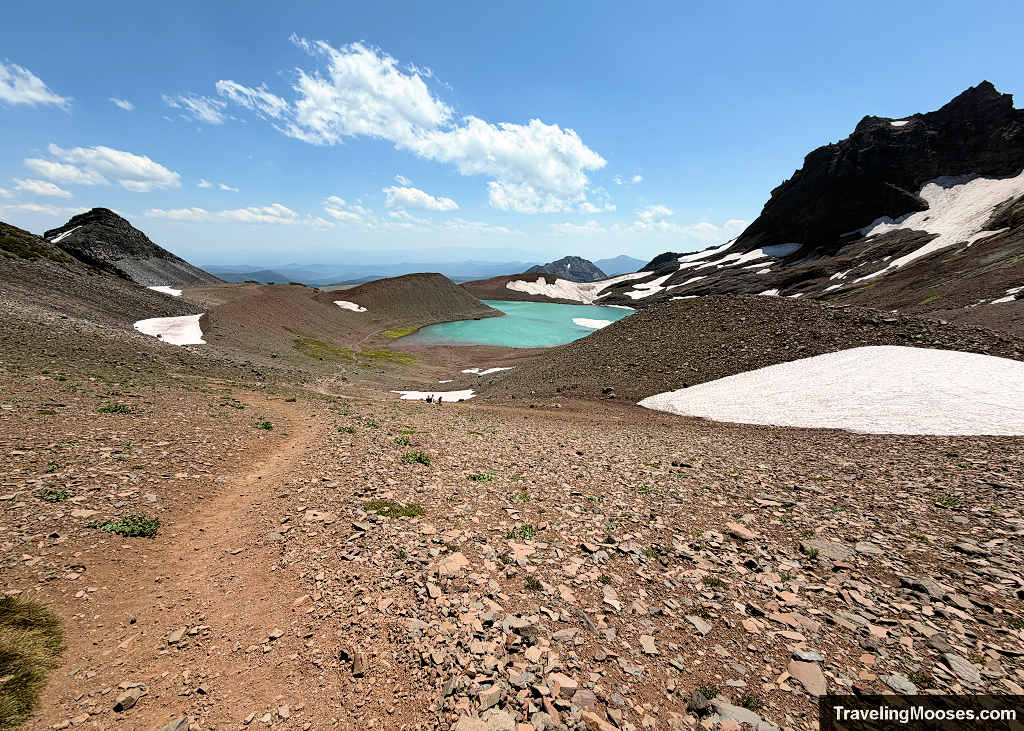
Topping out over this crest delivers another perspective of No Name Lake beneath Broken Top’s jagged amphitheater. From this vantage, the route continues forward to skirt the high ridge encircling the basin, bringing the most exposure of the day.
Topping out over this crest delivers your a beautiful look down toward No Name Lake beneath Broken Top’s jagged amphitheater. From this vantage, the route continues forward to skirt the ridge encircling the basin, bringing the most exposure of the day.
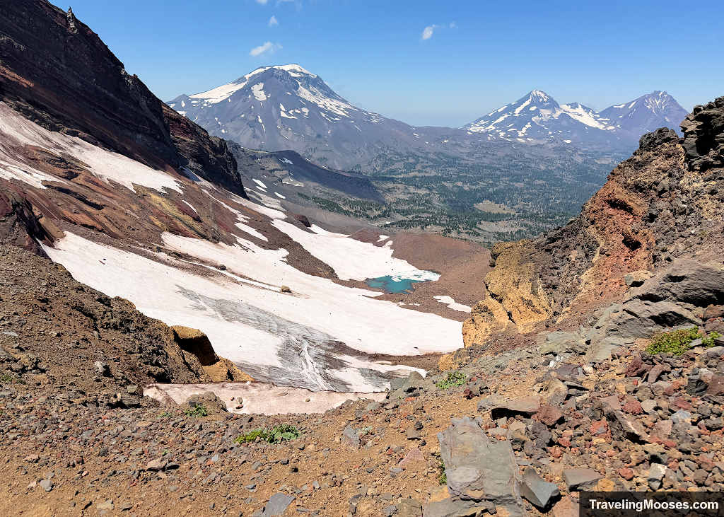
To your left, you have sweeping, dramatic views down into the turquoise water; to your right, sheer, vertical drop-offs plunge into empty space where a slip would be fatal. In dry late-summer conditions, the good news is that even with gusts pummeling you from the side, as long as you watch your footing, you will be fine. If there is lingering snow or ice along this edge, it could be catastrophic.
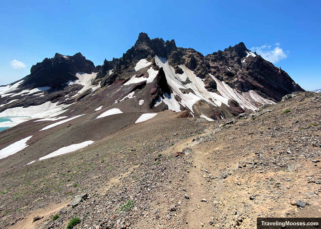
Skirting along this ridge brings you directly to the Bend Glacier viewpoint at the northern rim, looking straight down the entire length of No Name Lake with massive panoramas of the Three Sisters behind you. This is the classic vantage point that hikers coming up the easy Todd Lake trail climb up to visit for photos.
Standing on that windy ridge with the lake finally in full view, the only thing left between us and the water was one final, steep descent down a loose gravel slope that slid under our boots. Moving slowly and leaning into our poles, we picked our way down the sliding pitch to finally step onto the shoreline.
Enjoying No Name Lake
Down at the water’s edge, we were greeted by a large boulder sitting right in the shallows that made the perfect perch. We scrambled on top to eat a much-needed sandwich while battling chilly gusts that made it tough to stay warm once we stopped moving.
The natural amphitheater beneath Broken Top is alive with sound and movement. While we ate, we watched seasonal waterfalls cascading down the dark volcanic cliffs and even witnessed a small rock-and-snow avalanche tumble down the far headwall.

We also caught some prime mountain entertainment: a father and daughter doing warm-up push-ups on the gravel before they (and their dog) all leaped into the freezing glacial tarn for a cold plunge. The mom and son were smart enough to stay bundled on shore, and we happily cheered them on from the dry safety of our frigid rock.
After lunch, reality set in. The thought definitely crossed my mind to beg someone on the Todd Lake trail to let us hike down the easy side and hitch a ride back around to our car, but there was no way out except the way we came. It was time to turn around and face the ridge again.
Section 5: The Return Journey through Broken Hand (Miles 5.8 – 8.5)
By 2:00 p.m., the clock was ticking, and we still had a long route standing between us and the car. Standing at the shoreline while dreading the loose ridge traverse all over again was a heavy mental hurdle.
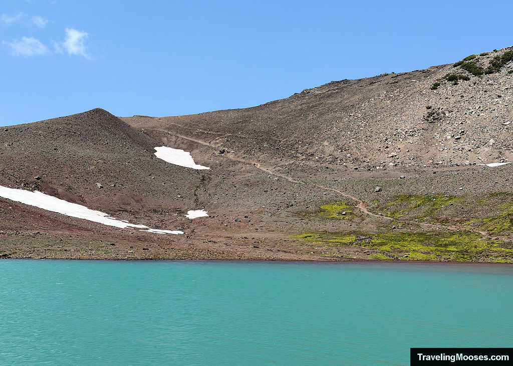
We started back up the steep, sliding gravel slope toward the Bend Glacier viewpoint and the Three Sisters panorama. By this point, the alpine wind was whipping at full force. It was howling so intensely that keeping hats on was out of the question without them launching over the precipice. With my hair whipping violently and no hair tie in my pack, my husband dug into his gear and handed me a black office binder clip just to pin my hair down so I could see where I was stepping.
Once back on the crest, the sideways wind felt forceful enough to shove us toward the sheer drop plunging off to our left. Taking our time and planting our trekking poles with every step, we pushed across the exposed spine back to the base of the dreaded Broken Hand traverse.
An alternative traverse around Broken Hand
Staring up at the high traverse clinging near the snowfield, we searched for a lower bypass across the basin to avoid repeating that nerve-racking scree pitch.
Contouring lower through the basin looked tempting, and there even appeared to be a faint user path picking through the scree farther down the slope. Ultimately, we abandoned the idea. With the afternoon wearing on, we weren’t confident where that line would pop out and were worried about burning precious energy scrambling through an endless field of awkward boulders.
In hindsight, reviewing the map post-hike revealed an unmaintained lower bypass was mapped right on AllTrails the entire time. It had been staring right at us, and we could have skipped the steepest exposure altogether.
Instead, we committed to the devil we knew: retracing our high line across the north face.
Surprisingly, the return crossing went far smoother than the morning ascent. Knowing exactly where the worst loose dirt and snow transitions were located made all the difference. A couple of loose steps still set my teeth on edge, but once we cleared the snowfield and rounded the shoulder to the front side of Broken Hand, the mental tension evaporated. I breathed a massive sigh of relief knowing the worst of the trail miles were officially behind us.
The final descent and the accidental Tam McArthur Rim Bypass (Miles 8.5 – 11.5)
It was time to cruise across the open volcanic plateau toward the trailhead. But heading east, we missed the high trail split without even realizing it.
On the morning climb, we had hiked directly to the official Tam McArthur Rim overlook, skirting uncomfortably close to that sheer cliff edge. On the descent, the unmaintained track didn’t appear to split and instead of climbing back toward the overlook, our path contoured lower across the plateau. Because it was wide, gentle, and pointing straight in the direction of the car, we gravitated toward it without noticing the fork.
My husband pointed out that the surrounding terrain looked completely unfamiliar. I initially argued it was just us not paying attention on the way up, but when we hit a junction marked with an old wooden sign pointing toward a “horse path,” I realized he was right: we had completely bypassed the official overlook.
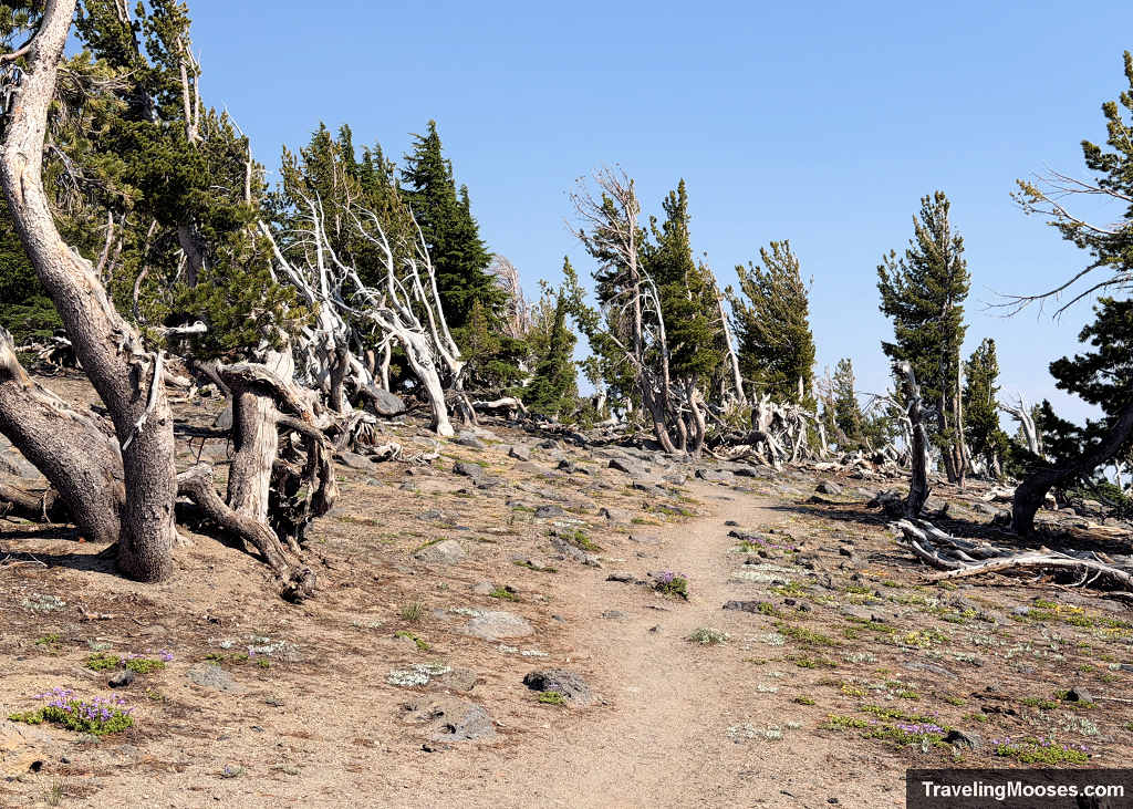
I know who’s surviving the apocalypse, and hint: it’s definitely not me. I’ll be far too busy freezing at the lake, forgetting the trail, and freaking out over exposure that most normal people wouldn’t look twice at. ¯\_(ツ)_/¯
Missing the rim was a double-edged sword:
- Taking the lower bypass completely spared me from having to walk that narrow, exposed cliff edge along Tam McArthur Rim.
- We missed catching one last view from the official rim overlook, which we had been looking forward to seeing.
Further down the ridge, we hit another trail split, but this one we intentionally took. Looking at our GPS map, the northern trail cut straight across the slope, acting as a direct shortcut to bypass the wider meadow switchbacks we had climbed that morning. We were exhausted and ready to be done, so we took it.
The shortcut quickly funneled us back into the main timber, where we powered down the shaded switchbacks through the trees.
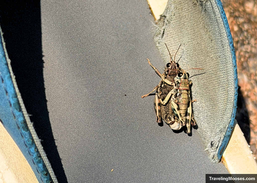
To top off an already eventful day, the trail had one last absurd surprise waiting for us. Sitting right off the path was a lone, abandoned flip-flop. Tucked neatly under the thong strap was a pair of grasshoppers, stacked together and thoroughly preoccupied. We couldn’t explain the missing shoe, but we certainly weren’t going to disrupt anything, so we left them to it.
We finally reached the car at Three Creek Lake after nearly nine hours on the mountain. It was an exhausting, demanding push, but standing at the edge of that turquoise glacial tarn beneath the amphitheater of Broken Top made every sketchy scree step worth the effort.
Final Thoughts: Is the Tam McArthur Route to No Name Lake Worth It?
If your primary goal is simply seeing the surreal turquoise waters of No Name Lake, it’s probably easier to secure a permit for the Todd Lake Trailhead or use a 4WD vehicle and drive up Forest Road 370 instead. You won’t be subect to the loose scree fields and ridgeline exposure near Broken Hand.
However, if you are looking for more rugged adventure, then the traverse from Tam McArthur Rim delivers. The sweeping, uninterrupted panoramas of Broken Top and the Three Sisters along the high crest are unmatched.
Be sure to download your offline map, pack solid boots and trekking poles, check current snow conditions before heading out, and know your limits. Turning around at the official rim overlook is an incredible hike all on its own. But if you do push past Broken Hand all the way to No Name Lake, it’s an alpine experience you won’t soon forget.