
Central Oregon is basically a massive volcano. The Newberry shield volcano stretches along the entire region (including underneath all of Bend). In fact, if you think about the active magma systems long enough, you might decide you don’t want to be there at all. But since the odds of a catastrophic eruption in our lifetime are basically zero, we wanted to see as many remnants of these volcanoes as possible.

Here are our top picks for the best volcanic sites and caves to explore.
How These Volcanic Sites Were Chosen
Fun to Explore and Uniqueness: A mound of lava rock isn’t worth a detour for us. We favored large calderas, lava tubes, and off-the-beaten-path caves over piles of rock.
Access & Road Logistics: Paved pull-offs with restrooms are completely different than driving ten miles of gravel tracks without cell service. We factored in road conditions, wildfire closures, and overall drive time.
1. Volcanic Sites and Caves We Completed
The Newberry Caldera Core
- Big Obsidian Flow Trail ~0.8 mi | 200 ft: You follow an elevated loop of stairs and gravel paths cutting directly through jagged blocks of jet-black volcanic glass and porous gray pumice. It’s short and different than any other trail we took in the area.
- Paulina Peak ~Drive-up or 6.0 mi hike | 1,600 ft: At 7,984 feet, the summit delivers a panoramic vantage of the entire collapsed caldera. You can see Paulina Lake and East Lake sitting side-by-side backed by towering Cascade peaks. The gravel road to the top is steep and narrow, but the payoff for minimal effort makes it worth it.

- Paulina Lake (Caldera Basin): The lake features beautiful waters amdist a backdrop of dark mountains. We stopped along the shore for quick photos, though our attempt to grab ice cream at the local resort store was thwarted when the clerk locked the doors and walked away mid-day. The restaurant was also closed that day, so plan ahead if you’re looking for snacks.
- Lava Lands Visitor Center Exhibits: The visitor center does a good job orienting first-time tourists to the monument, and provides historic information about the area. If you’re into history or want to take the shuttle up Lava Butte, this is a place you’ll want to stop.
Bonus Stop: If you want water with your geology, Paulina Falls spills right over volcanic basalt cliffs located near Paulina Lake.
Lava Tubes
- Lava River Cave ~2.2 mi out-and-back | 100 ft: The region’s most-visited mile-long lava tube. With 42°F temperatures year-round, high-ceiling tubes, and a steep concrete staircase descent, it’s an unusual walk into darkness. While the recreation.gov timed-entry system and family crowds can be a hassle, our advice is simple: book the first reservation slot of the morning and line up early at the gates to be one of the first cars in the lot. Being the first group to enter an empty, echoing cave completely changed our experience for the better.

- Skylight Cave ~0.2 mi | 50 ft: An unmanaged cave located down Forest Service dirt roads. You’ll need an OHV or a high-clearance vehicle to access the trailhead. After descending a rustic metal ladder through a roof collapse, you find yourself in a medium-size dark cave area. We had the entire cave to ourselves, which felt especially eerie. Wildfire smoke and an early morning arrival meant we missed the famous sunbeams streaming through the ceiling holes, but exploring it in isolation was still fantastic.

- Skeleton Cave ~1.0 mi guided: A deep, rugged, gated tube system tucked off China Hat Road. Because access is locked to protect sensitive geology and bat habitats, visiting requires a paid guided tour. The payoff is an unmaintained cave system with fewer crowds.
Craters, Cinder Cones & Lava Fields
- Pilot Butte State Scenic Viewpoint ~1.0 to 1.8 mi | 450 ft: The extinct cinder cone staring you in the face right in the middle of Bend. You can drive to the top, but we strongly recommend walking. Both the dirt trail and the paved road offer easy access. The 360-degree summit views across town and the Cascades are great, and you get the satisfaction of pointing at it from across Bend for the rest of your trip and saying, “I climbed that.”

- Lava Butte ~3.5 mi road walk/ride | 500 ft: A towering 500-foot cinder cone in the heart of the Lava Lands complex. Rather than paying for the shuttle van, we hiked it one day and rode our e-bike rentals up it on another. Reaching the rim under your own power and on your own schedule is well worth the effort.

- Fort Rock State Natural Area (The Amphitheater) ~1.1 mi loop | 100 ft: A colossal volcanic ring rising straight out of the desert. Portions of the rim trail were closed for bird nesting season when we visited, but completing the open section inside the ring delivered some nice views of the valley (and got us out of the smoke in Bend).
- Dee Wright Observatory (Highway 242 / McKenzie Pass): A stone castle-like shelter built out of jagged, porous basalt blocks, and located in the middle of the 65-square-mile Belknap lava flow. The viewing portholes set into the stone walls showcase the Cascade peaks and the entire flow area. While the observatory deck itself draws a steady stream of visitors, almost everyone skips the paved 0.5- to 1-mile Lava Interpretive Trail meaning you’ll likely have the actual lava walk to yourself.
2. The Wish List (What We Missed & Why)
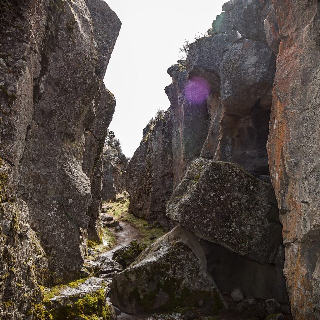
- Crack-in-the-Ground ~2.0 mi | 100 ft:
- Why we missed it: We had this slotted on our Fort Rock itinerary, but after hiking the ring, exploring Hole-in-the-Ground, and visiting the Fort Rock Museum, we didn’t want to add another 2-hours of driving to our trip.
- Why go: It’s a continuous, 2-mile volcanic tension fracture where you hike through a giant lava rock crack. It’s high on our list for a return trip.
- Derrick Cave ~0.5 mi:
- Why we missed it: We knew where it was, but we forgot our headlamps back at the rental. Navigating a dark cave on phone flashlights wasn’t on our agenda, plus we weren’t thrilled with the idea of another off-road route to get there.
- Why go: A massive, primitive lava tube that once served as a designated Cold War fallout shelter. No permits, no fees, and virtually no crowds.
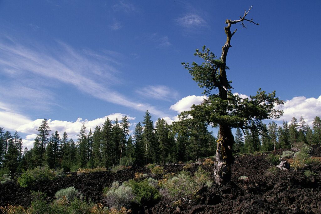
- Lava Cast Forest ~1.0 mi | 50 ft:
- Why we missed it: Our GPS wasn’t working and we hadn’t downloaded offline maps before leaving the rental. We found later there was a clear sign from highway 97 marking the turn-off.
- Why go: A paved, accessible loop trail winding through hollow tree molds created when a 7,000-year-old lava flow destroyed an old-growth ponderosa forest.
- Fort Rock Cave:
- Why we missed it: We didn’t know it existed until after the trip wrapped up.
- Why go: A federally protected national natural landmark famous for archaeological excavations that uncovered 9,000-year-old sagebrush sandals (the oldest known footwear on Earth). Access is controlled through limited seasonal State Park guided tours.
- Redmond Caves Recreation Area: Five shallow, self-guided lava caves located on the outskirts of Redmond. This is another cave system we didn’t know about.
3. Site Closures
- Black Butte ~4.0 mi | 1,600 ft: We intended to tackle this hike near Camp Sherman, but active wildfire activity shut down the forest roads and sealed off the area. While summiting to the fire lookout wasn’t in the cards, we did get a photo of its symmetrical cone framed from Cache Mountain.

- Boyd Cave: Located off China Hat Road, this 1,800-foot tube with a metal staircase entrance was closed due to ongoing forest restoration work.
- Arnold Ice Cave System and Wind Cave: This is another cave site people tend to enjoy but it was also closed.
4. Sites We Could Take or Leave
- Fourmile Butte Lava Flow (Sisters Backcountry / Black Cinder Flats): Located northwest of Fourmile Butte near the deep volcanic sand and cinder dunes off Highway 242. While having zero crowds was a plus, navigating rough dirt tracks to stare at an inaccessible, jagged wall of basalt rubble didn’t justify the detour. If you’re already out there exploring back roads or riding trails, it’s fine for a quick stop, but don’t treat it as a standalone destination.
- Hole-in-the-Ground ~0.5 mi rim walk | 100 ft: A crater located near Fort Rock that spans a mile wide and drops nearly 500 feet into the earth. It is completely undeveloped, free of interpretive signs, and devoid of tour buses. Frankly, we weren’t all that impressed. Access was tough and required an off-road vehicle. Google Maps also failed us out there taking us on a rough route when there were better roads available. Once you’re there you can drive to the bottom if you’re brave (we were not), or attempt to take a partial photo of the crater (unless you have wide zoom lens, it’s not happening).

More Volcanic Accessed through Alpine Hikes
If walking across flat lava beds and staring into roadside craters leaves you wanting more volcanic rock, you have more options.
- The “Other” Obsidian (Obsidian Trail Loop): Not to be confused with Newberry’s roadside Big Obsidian Flow, the Obsidian Trail off McKenzie Pass is a strenuous 12-mile alpine loop climbing through backcountry meadows and massive fields of volcanic rock under the Middle Sister. It requires advance planning and a Central Cascades Wilderness permit.
- South Sister Summit: The ultimate test of Central Oregon volcanic hiking. An unrelenting 12-mile round trip gaining nearly 5,000 feet of vertical, and finishing on sliding volcanic scree to reach Oregon’s third-highest peak and its glaciated summit crater.

What to Know Before You Go
- Headlamps: Phone lights are not bright enough underground. You’ll need a dedicated, high-lumen headlamp and backup batteries to explore.
- Temperatures: Surface temperatures may hit 90°F in July, but deep lava tubes stay at 40–45°F year-round. Pack warm clothes and wear good footwear to navigate the rocks.
- Download Offline Maps Early: Forest Service roads crisscrossing the volcanic zones east and south of Bend have minimal cell coverage.
- Passes: The Lava River Cave monument requires advanced purchase of recreation.gov reservations. They sell out quick, so make sure to reserve them in advance.